Where’s the Fishing?
Apparently, off southern South America, it’s just outside the Exclusive Economic Zone (EEZ) of Chile.
Here’s another nighttime DMSP satellite image composite from our friends at NOAA’s National Geophysical Data Center (as always, click to see a bigger version). We’ve planted it in Google Earth. It was made by combining three years worth of cloud-free nighttime satellite images, with 2011 displayed in red, 2010 in green and 2009 in blue. Look at the patterns of color out in the ocean, massed against Chile’s EEZ boundary, shown as a green line:
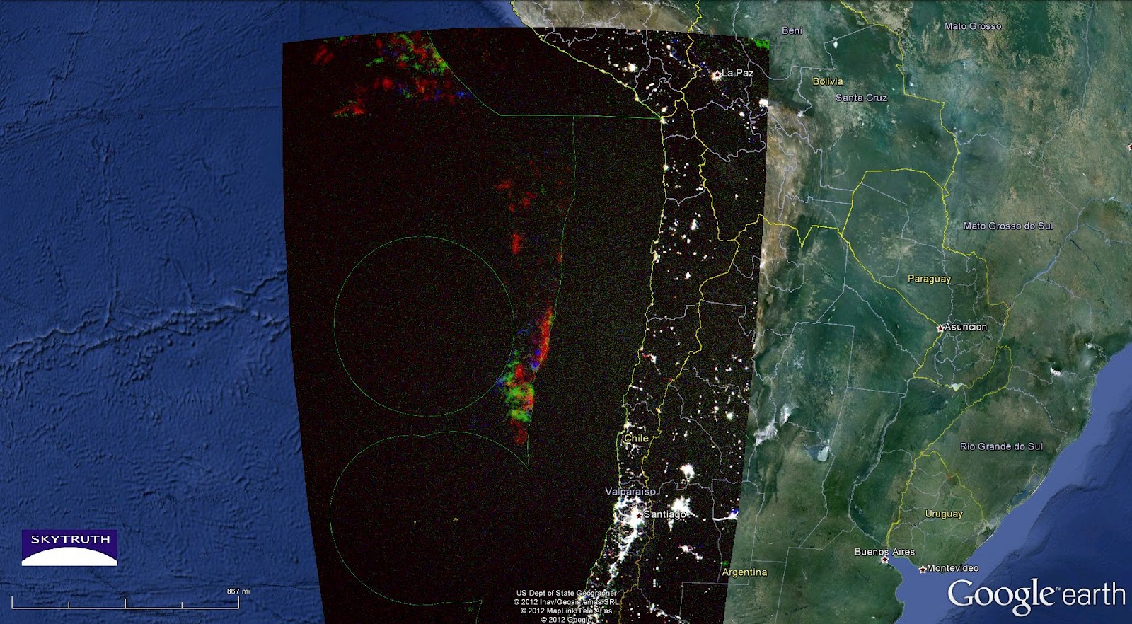
These patterns are probably made by the lights of fishing vessels: cargo ships are in a hurry to get from Port A to Port B, and don’t linger in the open ocean. There are a variety of fishing restrictions within Chilean waters designed to protect local fishing and fisheries by limiting industrial fishing, but on the high seas beyond the EEZ boundary anything goes. The fishing within Chile’s territorial waters must be relatively good, because this map shows that fishing vessels are trying to get as close as possible without crossing the line — although if you look closely, you can see indications of repeated incursions into Chilean waters.
Based on a study of Chilean fisheries, we think much of the fishing effort revealed on this image is probably targeting swordfish.