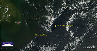
Slicks From August 30 – Back Again Today?
Tropical Storm Lee is long gone, the clouds are clearing, and the MODIS/Terra satellite image taken of the Gulf this afternoon seems to show a patch of dark slick located in the same place as the slicks documented by Bonny Schumaker on her August 30 overflight and confirmed on a radar image taken that same day. The dark patch under the yellow marker is roughly the same size, too, about 14 miles x 5 miles. And as before, there is no obvious connection between this patch of slick and BP’s Macondo well site. Maybe it’s coming from something else. We just don’t know yet.
Weather permitting Bonny may fly out there again tomorrow.
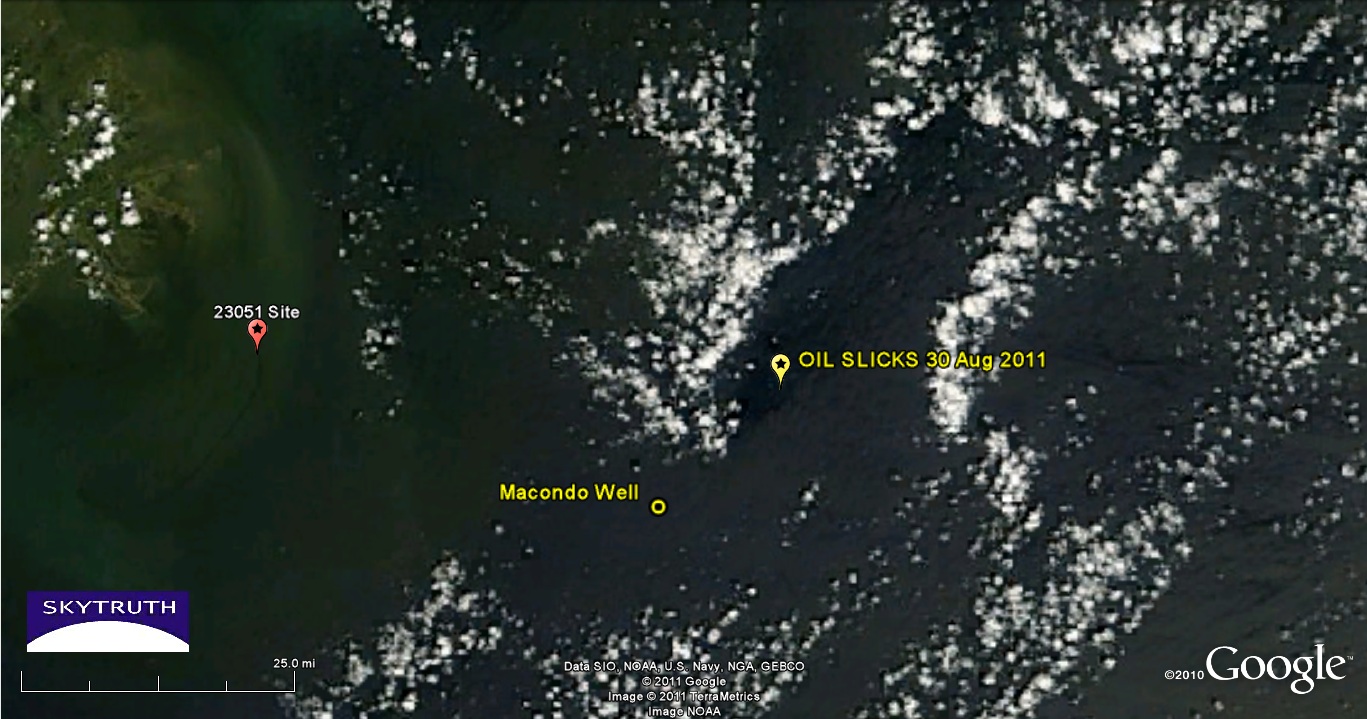
Detail from MODIS / Terra satellite image taken September 9, 2011 showing dark patch in same location as oil slicks observed on August 30.


I have had my eyes on this as well, and I am hoping we get a more clear view tomorrow. Current satellite data says the clouds are out of the way finally: http://www.wunderground.com/global/Region/g1/2xIRSatellite.html
Let us know what you see – our Gulf Monitoring Consortium is looking at the region very hard this week, with help from others. We'll blog and tweet what we find.