
Mariner Energy Gas and Oil Rig – MODIS Imagery, September 2, 2010
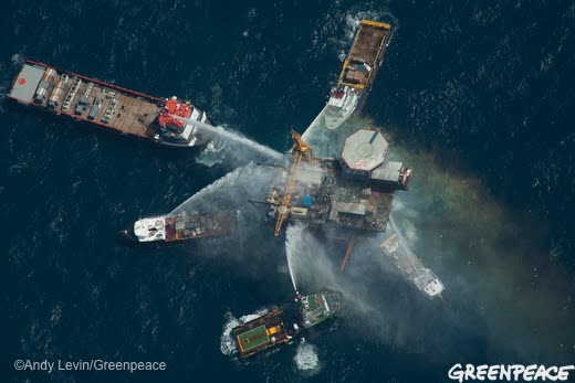
Fighting fire on the Mariner Energy platform in Vermilion Block 380, Gulf of Mexico, September 2, 2010. Photo by Greenpeace. More photos here.
Here at SkyTruth we finally got NASA/MODIS satellite imagery taken yesterday of the Gulf of Mexico, covering both the BP/Deepwater Horizon/Macondo well site and the location of the Mariner Energy platform that caught on fire yesterday morning while workers were painting it. Everyone was rescued and the fire was extinguished later that day. Early reports of a growing sheen of oil in the water were later retracted by the Coast Guard, and the seven wells under that platform have reportedly been shut in and are not leaking.
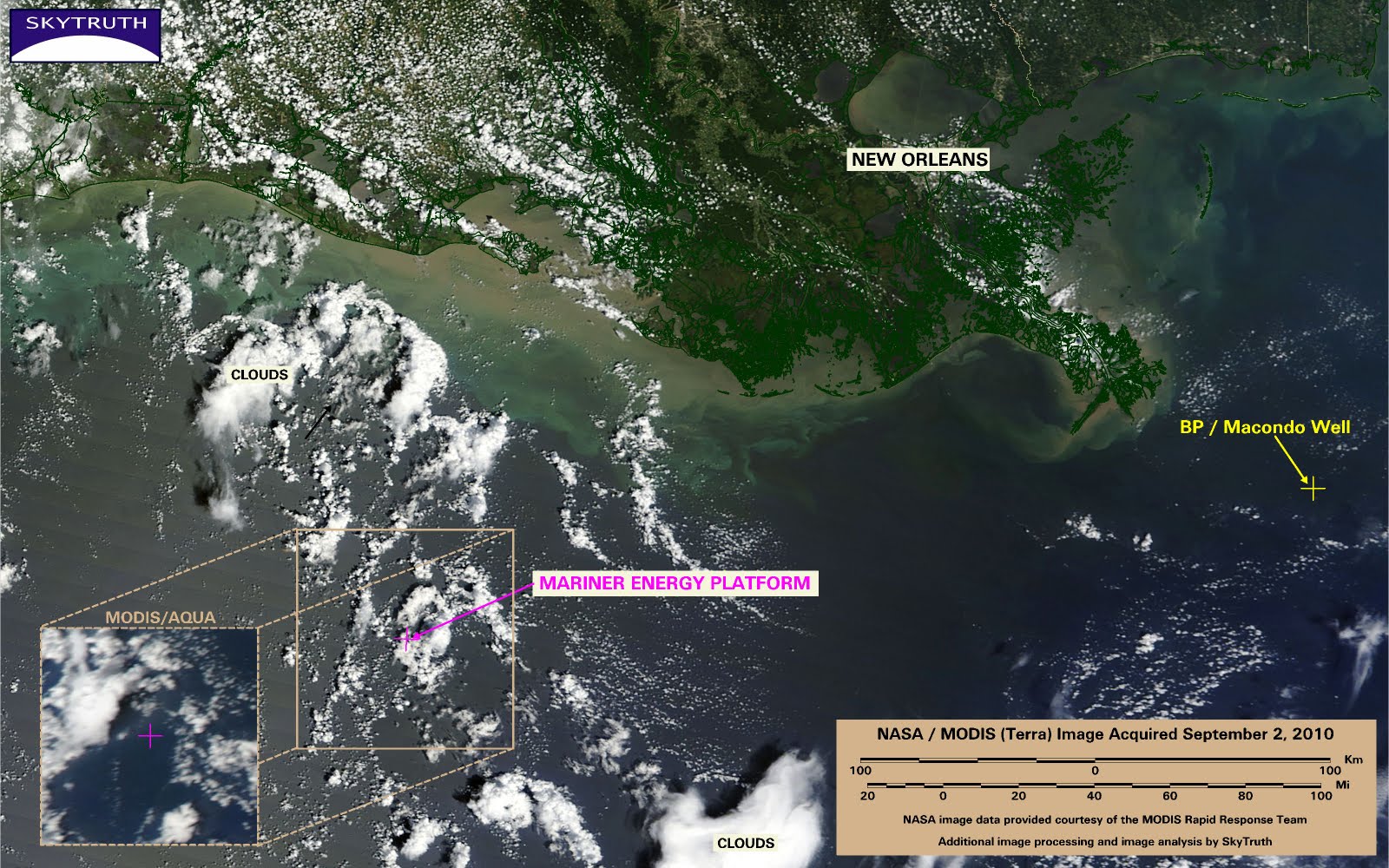
MODIS/Terra satellite image showing Mariner Energy platform (magenta cross) relative to BP spill site (yellow cross). Inset shows MODIS/Aqua imagery of the platform location taken an hour or so later.
NASA reported that the MODIS / Terra image taken at about 1pm local time showed a small plume of smoke from the burning rig, but the alleged plume is located about 40 miles northwest of the stated platform location, which we have verified by overlaying government GIS data for the locations of all oil and gas platforms in the Gulf. An offshore weather station on a Shell oil platform in the general vicinity reported wind consistently from the east to east-southeast. So we’re not sure what that reddish-brown blotch is that caught NASA’s eye – possibly a large patch of Sargassum, although it does seem to throw a shadow like the adjacent clouds, so maybe 1) it is a different smoke plume, or 2) everyone has misidentified the Mariner platform, which is very unlikely. Another little Gulf mystery.
BOTTOM LINE: We don’t see anything on the Terra image to indicate either smoke or oil slick around the Mariner platform location, but it is pretty cloudy. The Aqua image taken at about 2pm local time (inset) is clearer, but we don’t see anything unusual on it either. We’ll keep looking at the area for the next few days but this seems to be just another one of the 100+ “run-of-the-mill” fires and explosions that are reported on Gulf oil and gas platforms every year.

